Khaberni - In an unexpected discovery within one of the most isolated and harsh regions on our planet, a science expedition en route to the Antarctic was able to detect an island that was previously unknown. Initially, scientists thought it was just an iceberg covered with marine sediments before it was later revealed to be an actual land mass that had never been recorded on the maps before.
The discovery occurred during a research trip by the icebreaker "Polarstern", which belongs to the German Alfred Wegener Institute, carrying out a scientific mission to study ice and water flow in the Weddell Sea area, northwest of the Antarctic continent.
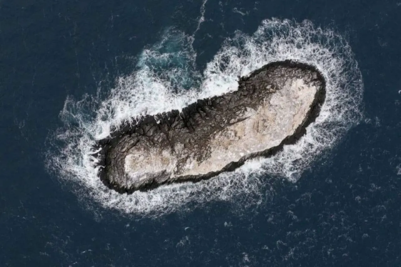
While the ship was moving in an area previously described on nautical charts as a "danger zone" due to the unclear nature of its terrain, the team noticed a mysterious object that was believed to be an unstable iceberg.
But as they approached and conducted initial measurements, doubts gradually faded, as data showed what was being detected was not a floating ice mass, but a solid rocky land, prompting scientists to completely reassess the site.
According to researchers, the newly discovered island is relatively small, roughly the size of the White House, covering about 6,200 square meters, rising only about 16 meters above sea level. According to the site "gizmodo". Despite its small size, it is considered an important discovery as it had not appeared previously in any geographic record or international navigational map.
The area has long been described on maps as a mysterious point for navigation, with a location error of approximately one nautical mile. This ambiguity led one of the geophysics scientists participating in the expedition to physically verify the nature of the area, before the truth was uncovered on the ground.
During the mission, the team used advanced maritime mapping technologies, including multi-beam sonar and three-dimensional depth measurement systems, along with drones to collect accurate data about the island's surface and coastline. These tools helped confirm that the discovered mass is indeed a rocky island and not part of moving ice.
According to the scientists, the ship was part of a broader scientific mission to study changes in sea ice and the effects of rising temperatures on the Antarctic continent, which makes this discovery an unplanned part of the trip.
Researchers also noted that the climate conditions in the region have seen a significant reduction in sea ice density in recent years, which may have contributed to the exposure of this land mass that had been hidden or confused with icebergs for decades.
Scientists are still studying the nature of this island and its formation history, in addition to the possibility that it had appeared before but was not documented due to the difficulty of accessing this harsh region. With the completion of the survey operations, the precise coordinates of the island will be added to the international navigation maps, while the scientific team still discusses a suitable name for it before officially adopting it in the global geographical records.
The researchers confirm that this discovery highlights that the Antarctic continent still holds many geographical secrets, despite the significant advances in modern exploration techniques, and that some “unknown areas” on the maps might actually hide features that have only been discovered by chance.