Khaberni - Starting from Wednesday, March 25, 2026, the Kingdom, God willing, will experience the peak of the Ghaith rainy condition, as it faces a deep atmospheric depression classified as fourth grade (highly effective) according to the Arab weather scale for the intensity of atmospheric depressions. This high classification comes in light of the strong effects expected on the southern regions of the Kingdom, bringing, God willing, widespread heavy rain and floods, as well as expecting snowfall over the southern summits, specifically the summits of Tafeila and Sharah.
A cold air front arrives Wednesday afternoon
Meteorological experts expect relatively cold and partly cloudy weather on Wednesday daytime with some rainfall in certain areas, progressing into the afternoon and evening when the kingdom begins to be affected by the deep atmospheric depression, as a highly effective cold air front moves through, intensifying the rain which becomes occasionally heavy accompanied by lightning and thunder and the occurrence of hail showers in several areas including the city of Aqaba, increasing the chances of flash floods.
Intensified rainfall in Aqaba city on Wednesday night/Thursday
As the hours of Wednesday night/Thursday advance, the rain will be heavy at times in the city of Aqaba, while showers continue intermittently in other areas.
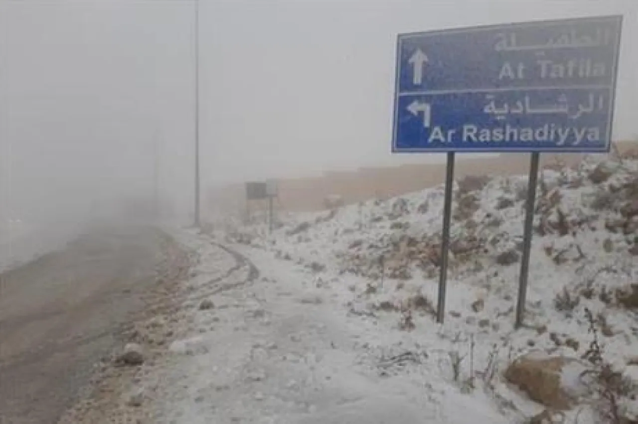
And during the dawn hours of Thursday, the impact of the atmospheric depression gradually intensifies in the southern regions, turning the rainfall into intense thunderstorms accompanied occasionally by heavy hail, and the possibility of snow showers on the high southern mountain peaks (high summits of Tafeila such as Al-Qadisiyah and Al-Rashadiyah, as well as the Sharah mountain range west of Ma'an, where the snow accumulates, God willing, increasing in depth with the rise in elevation above sea level).
Thursday .. the peak of the depression
A significant drop in temperatures will occur, becoming below the average by around 7-9 degrees Celsius, leading to cold and cloudy weather with rain and hail showers happening intermittently, particularly in some central areas including the capital and Madaba during the early morning until before noon.
As time progresses, the rainy condition will concentrate in the southern regions where heavy rain with hail showers is expected, raising the likelihood of flooding and transported floods in those areas.
Snow on the highlands in the south
Snowfall is expected at dawn and morning in the high mountainous areas in the south of the kingdom (Sharah mountains), becoming more regular over time during the day, with accumulation likely especially on the high summits, while the snow extends intermittently accompanied by occasionally heavy hail in the general southern highlands.
Winds will be southwesterly at moderate speeds, noticeably picking up in the afternoon and evening.
After Thursday
Thursday night/Friday and Friday: The weather will be cold and cloudy, with rain intermittently, heavy at times in the southern highlands, increasing the chances of flood formation. Rain continues on Friday sporadically, with the formation of fog and low-lying clouds touching the ground on the mountainous highlands.
Warnings and Recommendations
Given the saturation of the soil and the ground with moisture and water due to previous heavy rainfall for several days last week, caution is advised against:
1) The flow of wadis and streams
2) Formation of floods, including in the Jordan Valley and the Dead Sea areas
3) Occurrence of water puddles on the roads
4) Potential soil and rock slides particularly in the southern regions
And God knows best.