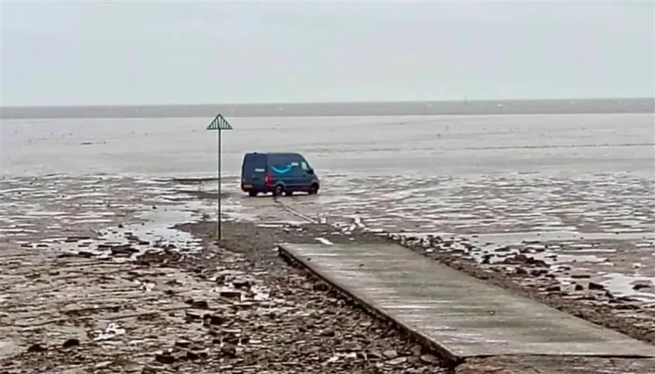
Khaberni - An Amazon delivery truck got stuck in dangerous mudflats in Essex County, UK, after the driver followed a route determined by the "GPS" system, which led to an incident that highlighted one of the most dangerous paths in the country.
"Broomway" is a sandy road that stretches for about 10 kilometers through mudflats between the coast and the island, dating back about 600 years, and part of the route is within a firing range owned by the British Ministry of Defense, making it a sensitive and hazardous area.
Not suitable for vehicles
Local authorities confirm that the road is unsuitable for vehicles and advise not walking it unless accompanied by an experienced guide due to the changing nature of the land and sudden rises in water levels.
The Southend Coastguard reported that it received a notification on Sunday about a delivery vehicle stuck on the historical road near Great Wakering, after the driver attempted to reach Foulness Island. The driver managed to exit the vehicle safely and report the incident to the company, with no injuries recorded.
According to local council records, about 100 people have died on this road over the years, earning it the reputation of the most dangerous pedestrian passage in Britain, although the last recorded fatality occurred in 1919.
Meanwhile, Amazon stated that it is aware of the incident and is investigating it. The company, in cooperation with a local farmer, arranged for the vehicle to be removed, while authorities confirmed that the situation is now safe.
The incident once again highlights the potential risks of complete reliance on Google Maps, especially in remote or hazardous areas that require local knowledge and special expertise for safe navigation.