Khaberni - The Israeli occupation authorities commenced on Thursday the construction of the "45" settlement road north of occupied Jerusalem, as part of a settlement plan aimed at connecting the settlements north of Jerusalem with those east of Ramallah to Jerusalem, and bolstering the settlement control around its periphery.
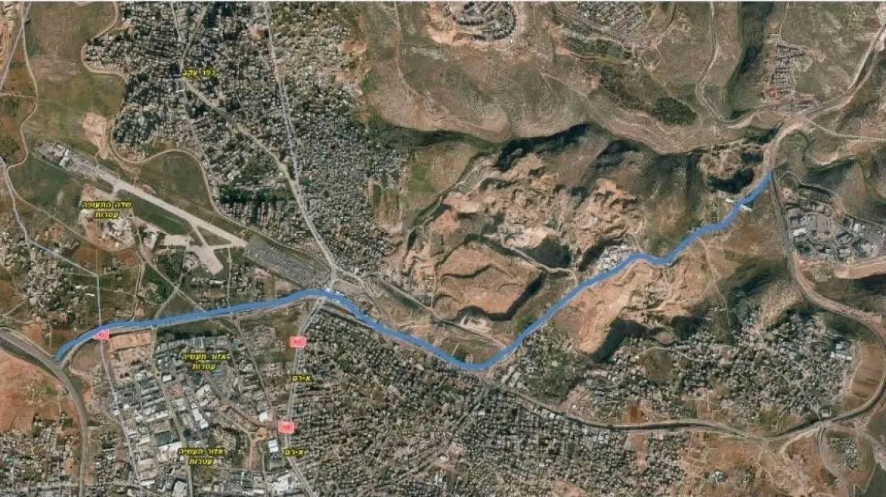
The Jerusalem Governorate reported that the road extends from the town of Mikhmas in the east to the Qalandiya tunnel in the west, later connecting to the "443" settlement road, with a current length of about 5 kilometers, within a system of settlement ring roads that tighten the noose around occupied Jerusalem and redefine the geography surrounding it.
It noted that the road aims to facilitate the movement of settlers and directly connect the settlement blocks north of Jerusalem and east of Ramallah with Jerusalem and the territories of '48, which contributes to promoting settlement and attracting settlers to reside in the settlements established around the city, in addition to controlling the eastern and northern slopes of Jerusalem, and altering the geographic and demographic character of the area.
The Jerusalem Governorate pointed out that the project serves as a central tool in isolating occupied Jerusalem from its Palestinian surroundings, severing the geographic continuity between the north and the center of the West Bank, as part of the practical implementation of the Greater Jerusalem plan in the Israeli concept, and imposing permanent settlement realities on the ground that serve the annexation project and entrench Israeli control over the city and its surroundings.
The occupation authorities had seized about 280 dunams of Palestinian lands for the road construction, belonging to the towns of Mikhmas, Jaba', al-Ram, and Kafr 'Aqab north of occupied Jerusalem, by military orders, despite objections from the locals. According to disclosed data, the road construction is estimated to cost about 400 million shekels.