Khaberni - The Meteorological Department warned of the impacts of a deep air depression and a very cold air mass affecting the Kingdom from Monday evening, accompanied by heavy rain, strong winds, formation of floods, and a decrease in horizontal visibility. The Kingdom will be affected by an air depression centered over the island of Cyprus on Monday night, turning the weather very cold, especially over mountainous heights, and becoming partly cloudy to cloudy, with rain in the north of the Kingdom gradually extending to the central areas.
The meteorologist at the Meteorological Department, Mohammad Sadiq, said that the Kingdom is experiencing low temperatures and very cold weather, especially in the mountainous areas.
He explained to "Al-Mamlaka": The highest temperatures in Amman range between 7 and 8 degrees Celsius, while the lowest range between one and two degrees Celsius. He also noted that areas in Shoubak might register temperatures below zero Celsius, with very cold weather.
He added that the northern areas, especially Ajloun, experience temperatures ranging between one degree Celsius and zero Celsius.
He pointed out that rainfall is heavy and in large quantities, indicating that snow falls on Tuesday above high elevations, with accumulations in the southern highlands, such as the Shara area, while the northern and central highlands, including Amman, will experience mixed rain and snow without accumulations.
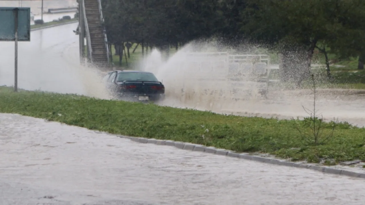
Sadiq explained that rain could be heavy at times and accompanied by thunder and hail, leading to the formation of floods in valleys and low areas, extending in the late hours of the night to limited parts of the southwestern areas. The winds are westerly active in speed, accompanied by strong gusts reaching between 70 and 80 kilometers per hour.
He warned of the risk of floods formation during the night hours in valleys and low areas in the north and center of the Kingdom, including the northern and central Jordan Valley and the Dead Sea, in addition to the risk of strong wind speeds and gusts, and the reduction of horizontal visibility due to dust, especially in the Badia regions, as well as due to fog and low clouds touching the ground surface above the mountainous heights during the night hours.
In the early hours of Tuesday, the Meteorological Department expected the deepening of the impact of the air depression and the very cold air mass, where the wind speeds intensify and temperatures drop significantly, making the weather very cold, cloudy, and rainy in most areas.
It explained that the rain could be heavy at times, accompanied by thunder and sometimes hail in some areas, leading to the formation of floods in valleys and low areas.
It also expected light snow showers on the high mountain peaks, sometimes mixed with rain, possibly accumulating sparingly on the high southern mountain peaks (Al Shara). It indicated that the winds are westerly active in speed with strong gusts reaching between 70 and 80 kilometers per hour, leading to dust storm formations in desert and Badia areas.
The department issued warnings for Tuesday about the risk of floods, the risk of hail and the formation of thunderstorms in some areas, in addition to reduced horizontal visibility due to fog and low clouds, and the risk of strong wind speeds and gusts, as well as the risk of dust storms and sometimes the complete loss of visibility in desert and Badia areas.
On Wednesday during the day, the Meteorological Department predicted foggy and cold weather in most areas, with the possibility remaining for light and scattered rain showers now and then in the western parts of the Kingdom, with chances of rainfall weakening in the evening hours and the weather gradually stabilizing, while the winds are westerly moderate in speed, active at intervals.
On Wednesday night, the weather will be very cold, especially over the mountains, and partly cloudy, with westerly moderate winds. The department warned of reduced horizontal visibility in the morning hours due to fog over the mountainous highlands and plains and parts of the Badia areas, in addition to the risk of frost formation and icing during the late night hours over high mountainous areas, especially the southern ones.