Khaberni - The Indonesian authorities raised, yesterday (Wednesday), the warning level for Mount Bur Ni Telong, in the province of Aceh in the west of the country, to the second highest level after recording a sharp and continuous increase in volcanic activity, which included a series of frequent volcanic earthquakes.
The Center for Volcanology and Geological Hazard Mitigation, under the Ministry of Energy and Mineral Resources, announced that the upgrade followed the monitoring of 7 shallow volcanic quakes and 14 deep volcanic quakes, as well as two tectonic quakes, in the hours leading up to the decision on Tuesday evening.
Also, 7 noticeable earth quakes were recorded between 20:43 and 22:45, felt by residents about 5 kilometers southwest of the summit.
10 decades of calm
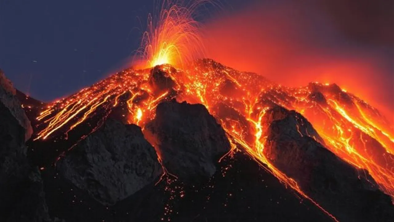
Mount Bur Ni Telong is a stratovolcano that rises to 2624 meters above sea level, located in the Bener Meriah district of Aceh, and is historically an active volcano, with the last eruption recorded in 1924.
Signs of increased activity began since last July, with around 10 deep volcanic quakes recorded until the end of December, but the activity became more intense and shallower during November and December, indicating potential movement of magma within the volcano.
Visual monitoring by the agency showed that the volcano is clearly visible and emits no smoke from its crater, yet warnings of a possible eruption were issued, including subsurface explosions and the emission of dangerous volcanic gases near areas containing volcanic craters emitting steam and gases.
Concerns of a sudden explosion
Lana Saria, Acting Head of the Geological Agency, explained that the magnetic activity is "easily triggered" due to tectonic disturbances surrounding the Aceh region, which increases the likelihood of a sudden explosion or an explosion driven by magma pressure.
The Indonesian authorities announced a set of precautionary measures including a prohibition on approaching within 4 kilometers of the summit, and residents in neighboring areas were asked to remain calm and follow local authority instructions, and hundreds of residents from the villages of Rimboni and Kampung Pantan Bediang in Keuchamat Timang Gajah were evacuated to temporary shelters (including Siah Kuala University complex).
The Center for Volcanology confirmed the continuous work of monitors around the clock to track changes in earthquakes and gases, with warnings that the situation could evolve quickly.
Indonesia is located on the Pacific Ring of Fire and is home to more than 120 active volcanoes, making it one of the countries most prone to volcanic activity in the world.